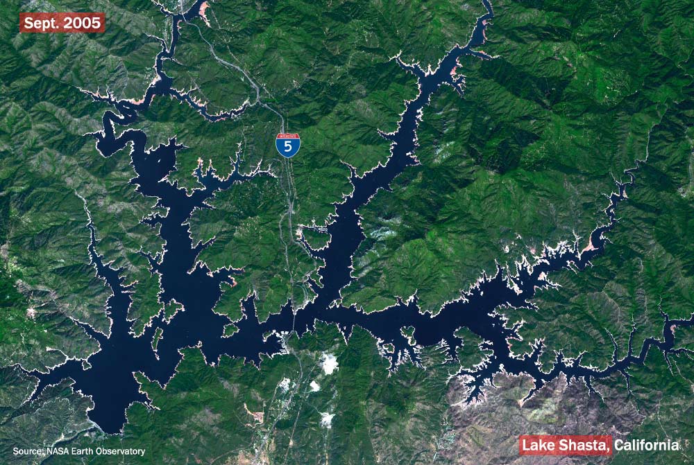
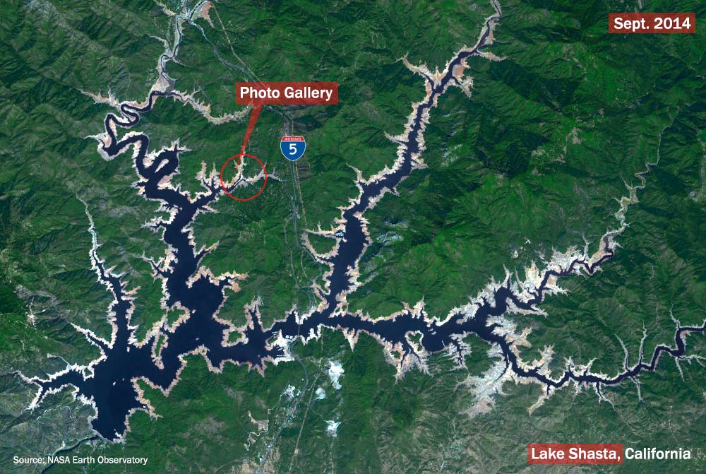
NASA’s Earth Observatory website released two images this week comparing Lake Shasta’s decline over a nine year period illustrating how drought conditions are impacting the western United States.
By using the slider below, you can see the change in water level photographed by the Terra earth facing observation satellite in September 2005 and September 2014. Water from Lake Shasta flows into the Sacramento River and is vital to growers in California’s Central Valley. NASA said the lake has dropped over 100 feet since 2005.
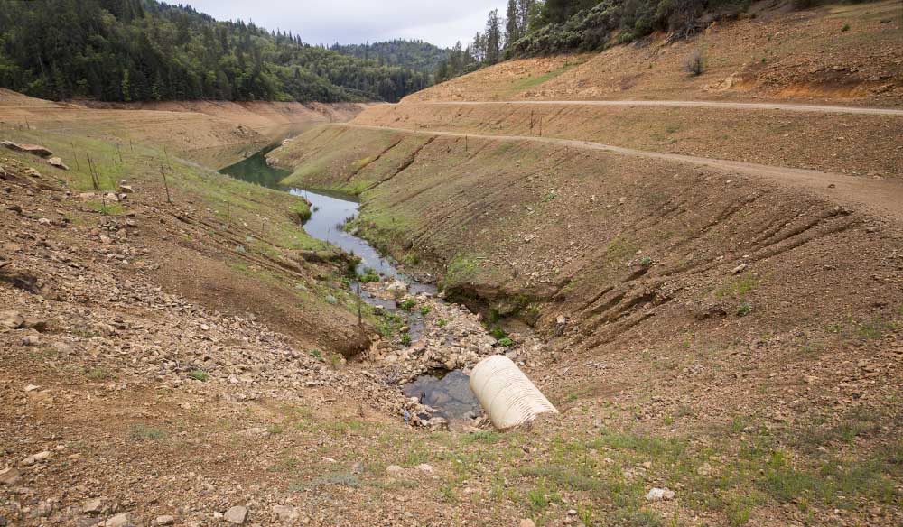
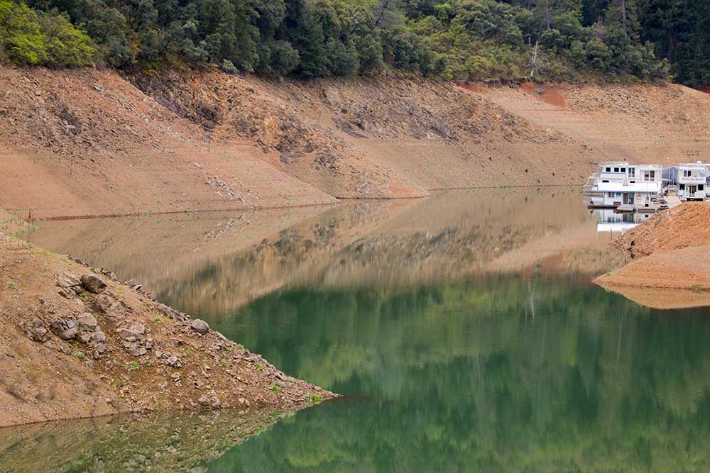
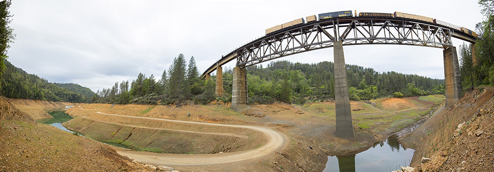
When I photographed these docks along Lake Shasta’s shore this past April, I was shocked how low the water line had fallen since my last time seeing them more than a decade ago. (photo gallery below)
At that time the docks were near a small tree-lined parking area. This year, I drove more than a mile down a makeshift gravel road from that parking area, over a long-dry lakebed to reach the docks.
The low water levels this year and recent high spring temperatures have increased the overall temperatures of the lake. In response, the Bureau of Reclamation halted a planned increase of water from Lake Shasta, forcing the bureau to increase flows from other California reservoirs setting up a host of new water management issues for the beleaguered state.
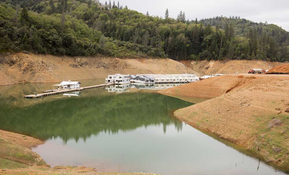
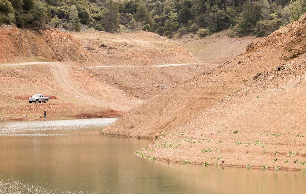
(Photos by TJ Mullinax/Good Fruit Grower)


Leave A Comment