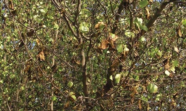
In April 2007, a freeze hit when many plant species, such as these Bradford pears in North Carolina, were weeks ahead in their life cycles and were sensitive to the cold.
What will the weather be like in the next decade?
Unfortunately, climate forecasts—weather forecasts beyond one year—aren’t nearly as accurate as your weather forecast for the next day. The science of forecasting the weather depends on knowledge of the factors that control the weather. In the short run, say out to 48 hours, we meteorologists have a good idea of what is going on. The controlling forces can be described mathematically and put into equations. The end result is a forecast of future weather.
Climate models attempt to do the same thing. For example, many models will use forecast amounts of carbon dioxide in the atmosphere as a controlling factor for temperature. Carbon dioxide is a “greenhouse gas,” and increased amounts of this should lead to higher temperatures. This is what many climate forecasts are based on. However, the relationships aren’t as clear-cut, and not all of the controlling factors are known for this extended time frame.
A simpler way of forecasting the future is using continuity. We can assume whatever trends we’re seeing right now will continue. We’re not really concerned with forcing factors, i.e., why the climate is changing. Almost all of the data we have indicates that it is getting warmer. For the United States, the pronounced warming trend dates back to 1970. Using continuity, we would then forecast even warmer conditions for 2010–2019. With that being said, this doesn’t mean every day or every month will have above normal temperatures. Nor will every year be warmer than the preceding year. The weather doesn’t work that way. There is too much fluctuation in weather patterns to produce that type of consistency.
If in fact it does continue to get warmer, the less frequent cold spells could pose an even greater risk of damaging crops. The devastating freeze that affected parts of the central Plains, Midwest, and Southeast in early April 2007, is a good example. Much-above-normal temperatures in March promoted rapid plant development. By the first week of April, many plant species were weeks ahead in their life cycles. They had already entered cold-sensitive phases. Fruit trees in particular were more vulnerable than normal this early in the growing season. The subfreezing temperatures took a tremendous toll.
Forecasts for precipitation would be even less accurate. Precipitation events are too ephemeral. One big storm during an otherwise dry period would skew the precipitation totals. It is the nature of atmospheric circulations that when one part of the country is wet, another part is dry. Drought should remain a transient problem in the upcoming decade. This is no indication we would see major shifts in agricultural areas such as those seen in the Sahel of Africa. Water shortages will develop in some regions, persist for some months, or even a few years in some locations, then disappear only to reemerge in another part of the country. Water issues will remain linked to economic concerns. Overall, there should be water available somewhere to meet all needs. It’s just a question if it is economically rational to transport the water to where it is needed.
One weather factor that we know has to be allowed for is the alternating cycle of El Niño and La Niña. In recent years, these events haven’t been as strong and haven’t dominated the Northern Hemisphere’s weather patterns. The strengthening El Niño, which developed last summer, might be more indicative of what we’ll have to deal with in the future.
El Niños tend to bring stormy, wet weather to central and southern California in the winter. The southern storm track often brings abundant precipitation to the southern tier of states. The Pacific Northwest is particularly dry, and below-normal precipitation often pushes into the northern states. Temperatures tend to be above normal and especially warm in the northern Plains.
La Niñas bring a reversal to the winter precipitation pattern. The states in the northern tier tend to be wetter, especially the Pacific Northwest. Southern California misses out on the usual winter wet season, and other southern states tend to be drier, too. Much of the country sees above-normal temperatures. Weakening weather patterns in the summer blunt the effects of El Niño or La Niña. However, as was seen this year, El Niños often bring diminished Atlantic tropical cyclone activity. Although damaging storms are less common, the often beneficial rainfall they bring is also missing. Unfortunately, El Niño/La Niña cycles are very irregular and difficult to predict.
The overall change in the climate over the next ten years might not be as important as the fluctuations that will inevitably occur along the way. And these changes can occur very quickly. For example, in 2007, Atlanta, Georgia, received less than 32 inches of rain for the entire year, just 64 percent of normal. Drought threatened the city’s water supply. In the first ten months of 2009, the city had already measured over 50 inches of rain, 125 percent of normal. Serious flooding has occurred. Extremes in weather are the norm. Average conditions are the aberration. Even if the extreme weather events in the future are no worse than we’ve seen in the past, the consequences are worse. We have become more vulnerable. This is the price we pay for increased development.
I’ve emphasized the transient nature of weather patterns and the local variations one must cope with. It is easy to lose sight of the big picture by being too provincial. Conditions at your location may not represent what is going on elsewhere. As a meteorologist, my advice to fruit growers, and everyone else for that matter, is, be ready to adapt. The weather will change. That is a certainty. Try to be prepared to deal with these changes whatever they may be.
Ed Brotak, a retired professor of meteorology at the University of North Carolina, is a freelance science writer. He has written a children’s book about the weather.
Leave A Comment