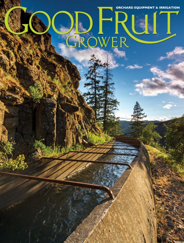
(Courtesy Phil Hull)
This canal clinging to the side of Tieton River Canyon looks like a canal from the past. Indeed, it may be quite old. The Bureau of Reclamation approved construction of the Yakima-Tieton Project in 1906.
The 12-mile long Tieton Main Canal, including five tunnels, would eventually deliver irrigation water to approximately 28,000 acres of land in the Tieton Division west of Yakima between the Tieton River and Ahtanum Creek. The first step was to complete 15 miles of wagon road with numerous bridges across the Tieton River in order to access the canyon.
The water distribution system would begin eight miles downstream from Rimrock Lake and empty into Ahtanum Creek 14 miles west of Yakima. In 1986, a new closed pressurized pipe distribution system was completed which replaced most of the original open canal delivery system.
The photo was taken by Phil Hull near Oak Creek, about 11 miles west of Naches, Washington, on Highway 12 where the canal winds along the steep ridge above the Tieton River.
It was taken on May 18, 2013, about an hour before sunset, and shot at 1/125 sec., f/7.1, ISO 200, using a Canon 7D digital camera with a Canon EF 10-22 mm f3.5-4.5 USM lens. A 3-stop neutral density graduated filter was used to hold back the late afternoon sun, enabling the photographer to properly expose the foreground.


Leave A Comment