Drones and satellites are mapping a handful of Michigan vineyards to reveal signs of struggling vines.
The researchers behind the effort, Michigan State University professors Paolo Sabbatini and Bruno Basso, say this particular form of precision viticulture is relatively new to Michigan, and they hope it will help them figure out why vines in some sections of the same vineyard struggle while those in other sections don’t — a common problem in the state. Struggling vines lead to low yields and lower fruit quality in general, Sabbatini said.
Basso said Italian grape growers use drone imaging to measure vineyard variability, which allows them to implement spatially variable management practices and helps them decide where to harvest first. Sabbatini said California growers use drones for similar purposes, but out West, they measure one major cause of variability: water stress.
“For us in the East, it’s more complicated,” Sabbatini said. “In general, we don’t have one single factor that makes a vineyard nonuniform.”
Sabbatini mentioned cold damage and soil composition as possible contributors to vineyard variability in Michigan.
Sabbatini, a viticulturist, and Basso, a crop modeling expert, discussed the problem of variability within Michigan vineyards — fruit ripening at different levels, vines growing at different rates, greater susceptibility to winter damage in some areas — and the need to find its causes. They decided to try precision mapping a couple of years ago and now are taking advantage of the Basso lab’s fleet of drones and satellite know-how to study the problem in specially chosen vineyards.
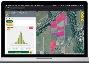
They aim to collect images from drones and satellites, combine them with more traditional ground-level data, and try to pinpoint missing vines and pockets of disease within the chosen vineyards. They also want to learn if patterns of spatial variability are stable or change over time. Now in the second year of research, they will gather data for another year or two before starting to draw conclusions, Sabbatini said.
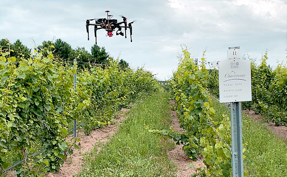
The researchers are studying two main sites: a trial block of Concord grapes planted a decade ago at MSU’s Southwest Michigan Research and Extension Center, and a plot of wine grapes at Brys Estate in Northwest Michigan, Sabbatini said.
Coenraad Stassen, Brys Estate’s winemaker and manager, said the MSU team is studying a 14-acre plot of Cabernet Franc, Pinot Noir, Merlot and Chardonnay using drone, satellite and ground-level observations. Stassen said he’s used to the “old school” approach to measuring vineyard health: walk every row, study every vine and taste lots of berries. That method is time consuming, whereas a drone can learn in two or three hours what it would take him days to learn in the field — and probably do it more accurately.
“The research is incredible,” he said. “The better you understand your plot, the better fruit you grow, and the better wine you make.”
Basso’s lab works mostly with larger-scale commodity crops like wheat, corn and soybeans. Grapes are grown in much smaller plots than he’s used to, but drones and satellites can map them just as well, he said.
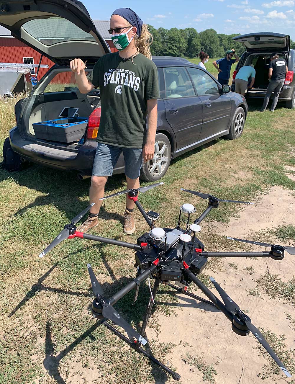
Basso’s team flies drones over the trial grape plots three or four times per season. They also download daily satellite images. Satellites can measure the ground with a resolution of up to 1 meter, but drones, with a resolution of less than 1 inch, are even more precise, he said.
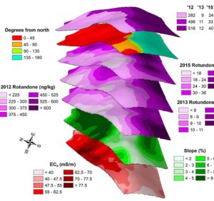
The drones use three sensors: multispectral, which measures reflected light from plants (one way to look for disease); lidar, which measures plant height (one way to determine the level of growth); and thermal band, which measures canopy temperature (another way to look for disease or water stress). When you integrate the data from all three sensors, you “start connecting the dots,” he said.
At harvest time, the team takes ground-level measurements of Brix, biomass, cluster number and other factors and compares them to the in-season imagery data from the drones and satellites, Basso said.
The researchers are using the data both to count vines and identify disease. Michigan’s harsh winters can damage a lot of vines, and growers need to know how many they’ve lost, and where. More information about disease spots will also enable growers to better focus their sprays, Sabbatini said.
“Devastating diseases and pests impact vine growth and grape production, causing enormous losses annually,” the viticulturist said. “Unfortunately, traditional management approaches result in additional costs for growers and often are very inefficient. Precision viticulture technology is changing that.”
—by Matt Milkovich


Leave A Comment